A journey across to Kangaroo Island turns the pages of history and opens new chapters in life

Only a few will read this. They are the ones who will understand and appreciate the journey.
You need to be willing to respect and admire the beauty and resilience of nature.
You need to look at Kangaroo Island as a gift … to see it and experience it from an honest perspective.
Anchored off the southern tip of South Australia, it is a natural ecosystem caught by European inhabitation over the past 200 years.
The native plants and wildlife have been somewhat isolated by the stretch of water between Cape Jervis, on the mainland, and the island.
At the same time there are mixed farming areas on the island … mainly sheep and cattle, along with grapes and grain.

Don’t expect a lot of nightlife in the few scattered towns.
But you can seek out and watch – from a distance – the native animals that do come out at night. It will amaze you.
The funny thing about Kangaroo Island is that on the few days we were there … we didn’t see any kangaroos.

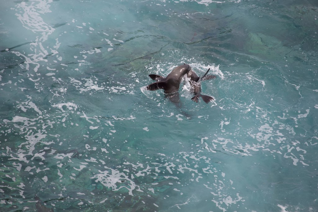
However, there were up-close sightings of koalas, seals and even little penguins. No echidnas either … or wombats … but a shark was spotted near the jetty of the little settlement where we stayed.
According to Wikipedia, on 23 March 1802, British explorer Matthew Flinders, commanding HMS Investigator, named the land “Kanguroo Island” due to the endemic subspecies of the western grey kangaroo.
He was closely followed by the French explorer Commander Nicolas Baudin, the first European to circumnavigate the island and who mapped much of the island – which is why so many areas have French names.
Although the French and the British were at war at the time, the men met peacefully in the waters of St Vincent’s Gulf. They both used the fresh water seeping at what is now known as Hog Bay near Frenchman’s Rock and the site of present-day Penneshaw.

Sadly, both explorers had inappropriate ends to their careers despite having discovered and recorded so much about the lands at the other end of the world from where they were from.
Discovering footnotes in time such as this highlights the benefits of travel for an inquiring mind. History lessons at school can only tell you so much – and the accounts are written from the perspective of the author.
On the return voyage the ships stopped in at the island of Mauritius in the Indian Ocean, where Baudin died of tuberculosis on 16 September 1803.
His work and the achievements of the expedition were largely disregarded in France. This neglect stemmed from several factors, including animosity within the ranks of the expedition, delays in publication, and the focus on other national priorities.
Flinders was imprisoned in Mauritius in 1803 for nearly seven years, after being accused of spying by the French governor.
But more about that later.

Today, getting to Kangaroo Island is relatively easy but due to the immense distances in Australia it had taken me half a lifetime to take the step – or the ferry.
The opportunity to explore Kangaroo Island came on the back of deciding to attend Australia’s premier endurance horse riding event … the Tom Quilty 2024 Gold Cup.
That was being held at Wirrina Cove on the Fleurieu Peninsula, with Cape Jervis at the southern-most tip.
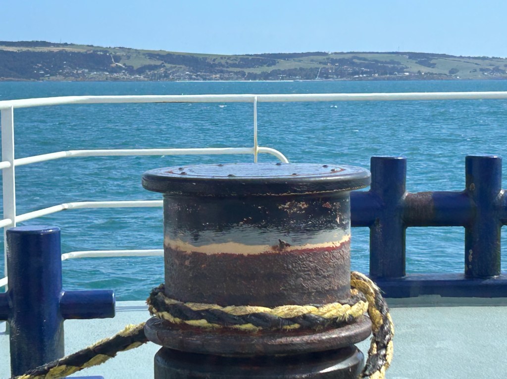
So it made perfect sense to take the opportunity to load the car on the ferry and duck across to the island.
After all, we had driven for three days and nights through four Australian states to get to the Fleurieu Peninsula, so why not go the extra few miles.
You can see travel brochures and documentaries, but they don’t really prepare you for the reality of this island.
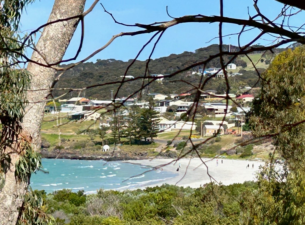
There are working towns … Penneshaw and Kingscote being the main ones.

Kingscote is South Australia’s oldest European settlement and the island’s largest town. Yet it is predominantly agriculture and the natural environment that sits at the heart of the island.
Tourism and fishing also play significant roles, with more than 186,000 visitors a year.
At Penneshaw, there are viewing areas for the little penguins on the beach, an arc of sand from the ferry terminal around to more residential areas. There’s low scrub and native grasses on the sand dunes, some seaweed and kelp on the beach itself.
The penguins just wander ashore at dusk and return to their burrows or nests after a day fishing at sea.
Penneshaw is also a place to check your fuel and stock up with supplies at the supermarket.
What Kangaroo Island offers is magnificent walks and glorious, secluded beaches. And there is a variety of ways in which to enjoy it … from clifftop resorts facing the Great Southern Ocean to beachfront and roadside camping areas as well as the more regulated campgrounds.
What visitors must consider though is this relatively pristine environment. So it is illegal to bring in many varieties of fruit and vegetables. Potatoes and honey are perhaps the most important in order to protect the KI industries.
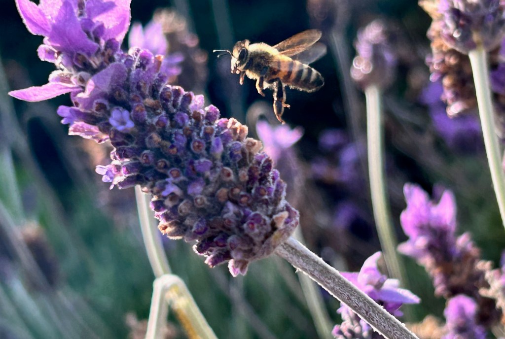
This includes bee-handling equipment, potatoes for consumption or planting, grape vine cuttings need to be certified.
Washed or brushed potatoes in new packaging are permitted for consumption only.
Introduced species to Australia such as foxes, rabbits, deer and ferrets do not occur on Kangaroo Island and the introduction of these pests would create an environmental and agricultural disaster.
Kangaroo Island is having great success in its attempt to eradicate feral cats from the Dudley Peninsula.
The damage they do to both the native wildlife and domestic animals is immense, so the Kangaroo Island Council have introduced by-laws relating to the keeping of pet cats.
There is a list of declared weeds and any grape vine cuttings must be inspected and certified.
Fresh fruit and vegetables from a declared fruit fly outbreak area are not allowed.
You need to be aware of these restrictions as they are a safeguard protecting the beauty of the island.

Getting there can be a simple as a plane flight to the island then either hiring a car or relying on the transport of resorts.
However, the ferry service offers the opportunity of taking your own vehicle and being independent in your travels as there is so much to explore.
The Cape Jervis Tavern on the mainland was a good spot to have a counter lunch while waiting for the ferry departure – a good meal, and an informative host who provided a history of South Australian beers, brewers and the different glass sizes – such as a “butchers.”
These are believed to come from the habit of butchers having one or two glasses during their lunch break but the glasses were not large enough to affect their work.
We found that with a vehicle and two travellers, the cost was about $1000 for the return trip.
The best way to describe Kangaroo Island was it being a bigger version of Phillip Island … which is situated at the entrance to Westernport Bay, to the south east of Melbourne in Victoria.
Whereas Phillip Island is probably 25km long and 9km at its widest, it narrows to about 500m at one point.
Kangaroo Island would be 155km long and 55 km wide.
Phillip Island is connected to the mainland by a bridge so the population ranges from 15,000 permanent residents tabour 40,000 in peak holiday times.
The population of Kangaroo Island is about 5000.
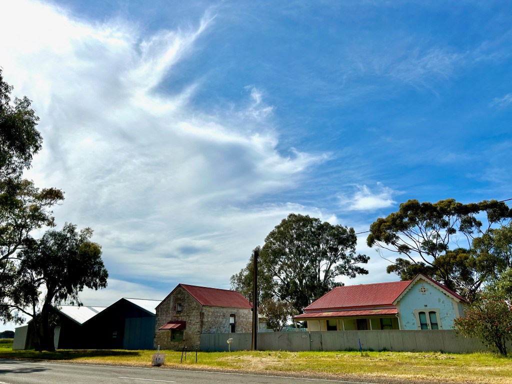
Overall, the roads are good and we were able to navigate things well in a conventional vehicle. The thing you have to remember is that it’s just like a country region in Australia. Most of the roads are sealed yet others are a mixture of sand, gravel and clay.
The main roads seem mostly to have a speed limit of 100 km an hour but for the others you need to really just drive to the conditions and remember – this is a place without traffic lights.
It’s a place with few roundabouts. It’s a place with few stop and give-way signs so that if you come to a intersection whether it’s a crossroad or a T intersection you have to be ready you have to be aware you have to be prepared for the traffic coming the other way.
And then you have to be prepared for wildlife or, in some situations, wandering livestock. There is a wonderful relaxed pace about life here.

Kangaroo Island was severely impacted by bushfires in early 2020 at a time when Australia was alight right along the east coast – from the wet tropics of North Queensland to the forests of the southern highlands.
Remarkably nature has done an amazing job at regenerating itself yet it has also highlighted the ways in which the national parks and wildlife services come to the rescue.
At the same time the local inhabitants responded and were reminded this is where they live. This is their future.
Kingscote is the main business area on the southern coastline but there is also a settlement at American River.

The main resorts are on the ocean side but we chose to stay in private accommodation at Emu Bay.
The decision was made plain for us because the hosts Anne uses the funds to help support and care for native wildlife.
The reference to Phillip Island flows through in that Kangaroo Island reminded me of growing up in the 1960s and 1970s.
There were penguins, koalas and short-tailed shearwaters at Phillip Island. Those experiences were to be relived here on Kangaroo Island … though we didn’t know it at that stage.
An early morning walk to capture the sunrise brought back the familiar sounds of koalas. The grunting sound that also reminded you of a bull bellowing. Perhaps a mating call?
Just as on Phillip Island, where they would roam around the streets and gardens of the small communities, this was happening here and my colleague was eager to explore more … but without success at the time.
However, there was a remarkable encounter later in the day and that will need a separate post.
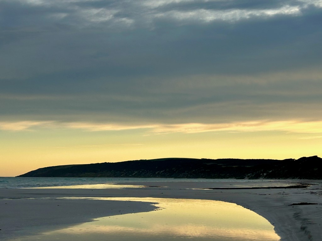
The walk along that long crescent beach in Emu Bay was broken only by sea birds and the waves. Much like the coastline of K’Gari, what was known as Fraser Island, in Queensland.
Returning to the Emu Bay jetty, reminded me of catching the school bus from the farming area I grew up in – but also of the visit to the Southern Tyrol in Italy, right up against the Swiss and Austrian borders. There, the school children would come running down the hill from the houses and farms to catch the bus waiting in the town centre.
It was like this at Emu Bay, with the school bus parked near the jetty, and children would either walk down from the houses or get dropped off by car from the surrounding farms.
We had been given great information by our hosts about what to see, where to go, and what to do on Kangaroo Island.
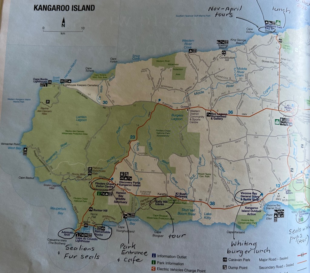
Our plan for the day was simple … drive to the eastern end of Kangaroo Island and work our way back, seeing what we could discover in between.
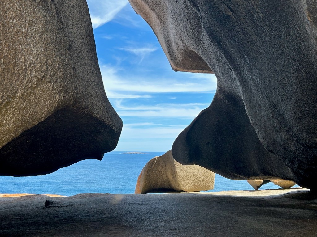
The main objectives were the seal colonies at that eastern end but also the rock formation on a peninsula, aptly named The Remarkables.
The other must-do was to stop at Vivonne Bay and try the fresh whiting burger at the general store. That was going to be on the return journey and we needed to make sure that our timing would work with that.
Vivonne Bay is spectacular, as good as any of the remote beaches in Western Australia – crystal clear and the brightest of blue water, then the stretch of white sandy beach and the ochre red of the gravel roads.

The natural bushes and wildflowers were re-establishing themselves from the bush fires under this clear blue sky.
During an unusually scorching hot summer, lightning strikes ignited fires first on the north and north-eastern coasts of the island in late December 2019, then in Flinders Chase National Park 10 days later.
Over several weeks, the Kangaroo Island fires burned 211,474 hectares of land, almost half of the island. It is unknown how many of the island’s wild animals perished, along with the estimated 32,000 head of stock and domestic animals that died.
The widespread fires also damaged or destroyed homes, businesses – including some tourism venues – grazing land, forests, crops, machinery, and infrastructure, and two people tragically lost their lives.

There was a slightly surreal moment just after we entered the Flinders Chase National Park.
A beautiful architect-designed information centre is a good stopping point, and it features plenty of rainwater collection, solar for EV charging stations as well as computer work areas for backpackers.
From a car-parking area you can catch a bus for a tour to Admirals Arch to see the seals, and probably The Remarkables as well.
We were self-driving but found the roads narrower inside the park and while looking for signs to see which way to go, we noticed a small flock of birds on the side of the road – maybe six or eight – and much like some that I’d seen on Philip Island years earlier.
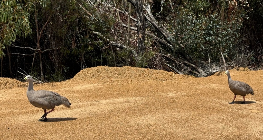
They were just on the side of the road and resembled guinea fowl … only bigger. Probably 30-something centimetres tall, larger than a rooster but smaller than a turkey.
To which my co-driver exclaimed: “Oh no, they are directional signs pointing the way we’re supposed to go … how cute.”
Nope. They’re moving.
We stopped the car. They would’ve been the length of a cricket pitch away … 20 metres or so.
A phone camera zoomed in.
“You’re right they are alive!”
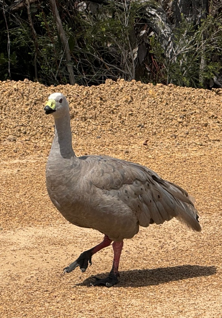
Quick research showed they were Cape Barron Geese, found only in Australia and one of the world’s rarest geese.
Once hunted for food almost to extinction, conservation efforts have seen their numbers increase considerably.
Pale grey with black markings near the tips of the wings and tail, they are grazing birds and have the ability to drink salty and brackish water which allows them to populate areas without freshwater and to remain on offshore Islands all year round
They are flighty birds and best viewed from a comfortable distance to avoid disturbing them. Approach them cautiously and if they change their behaviour and show signs of alarm give them some more space.
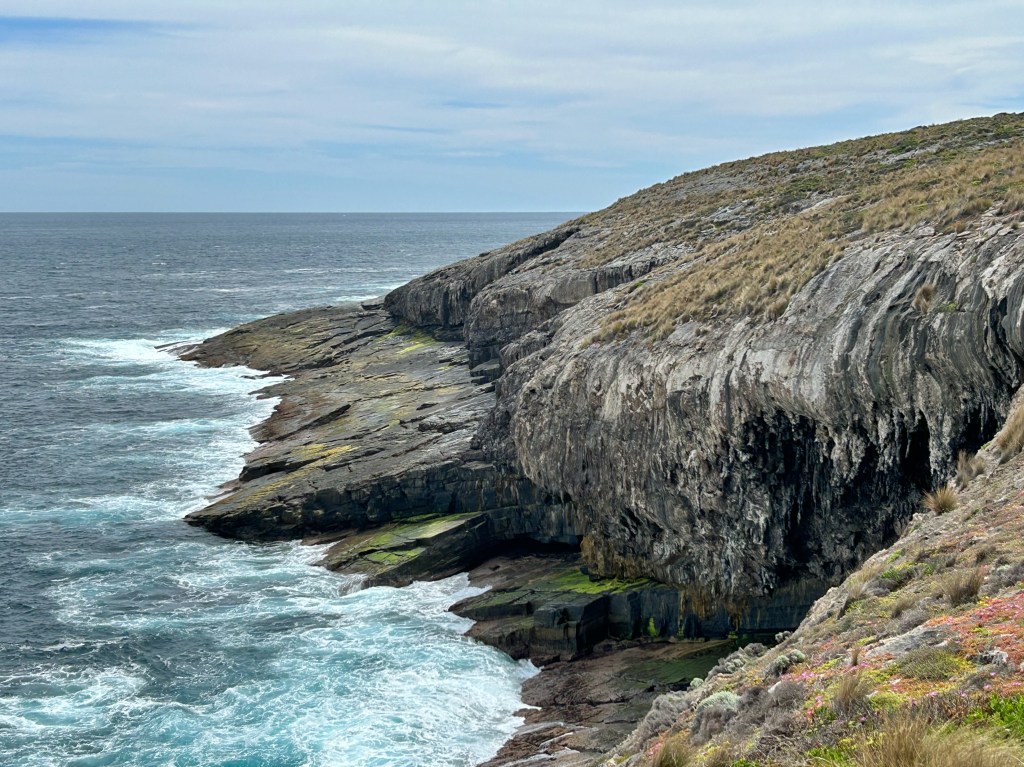
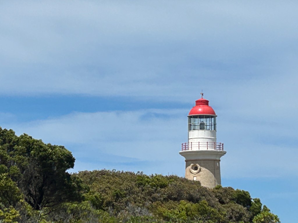
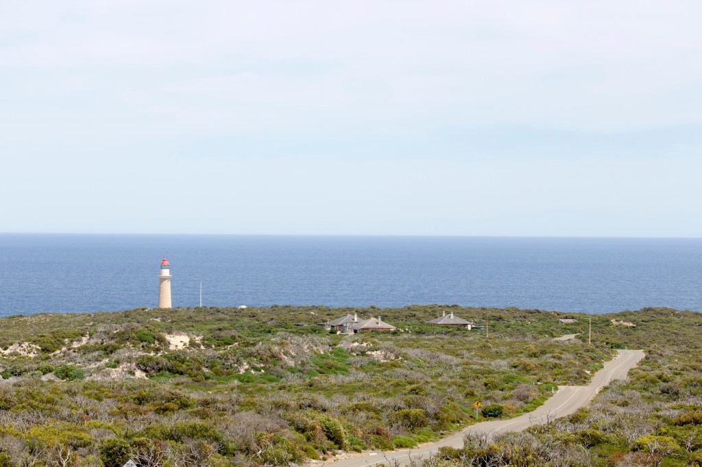
The decision to explore Admirals Arch was so worthwhile in so many ways. On the island’s south-west edge, near the Cape du Couedic Lighthouse, it is a significant natural landmark known for its unique geological formation and the New Zealand fur seal colony that inhabits the area below.
The arch is a result of thousands of years of erosion by the ocean and wind, shaping the cliff face into its current form.
A boardwalk leading to the this distinctive rock bridge is nearly as scenic as the landmark itself.
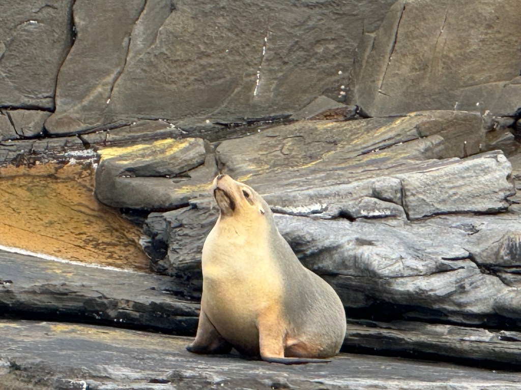
There are two key locations to fully comprehend the grandeur of the arch. The top outlook enables you to watch the seals playing, swimming or just lazing around.
Then there is a further set of steps which takes you down to view the seals closer and experience the wonder of the arch.
Definitely go the extra yards.
The seals are just lying around in the sunshine or swimming in the ocean – playing with their mates, surfing with the surges of the waves.
As far as wildlife experiences go, this is exceptional. It highlights the natural attraction of the island.

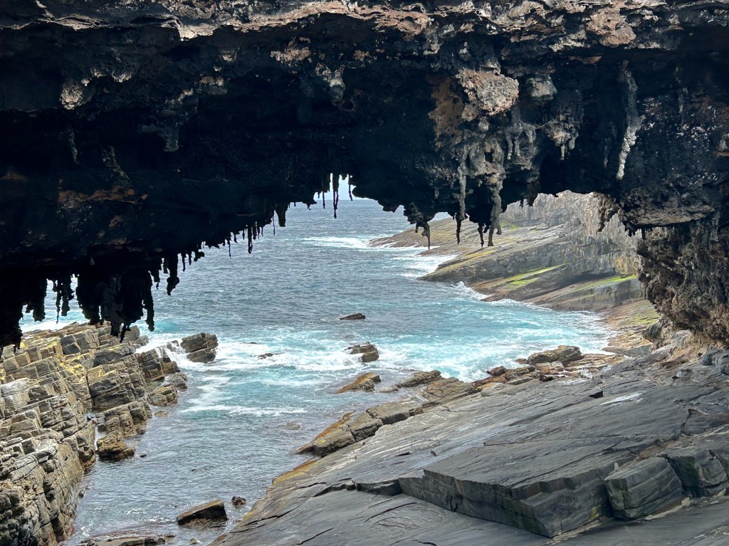
The second recommendation was The Remarkables – a rock formation just along the coastline from the seal colony.
This stunning work of nature balance on top of granite outcrops, shaped by the erosive forces of wind, sea spray and rain over some millions of years.
The top of the rocks have fractured, giving an opportunity for the erosion to create the shapes that are there now.
The advice we had been given to see these special places was in itself remarkable. Again, there is good boardwalk access to viewing areas but care needs to be taken on the bare rockface of the outcrop itself.


The return drive had us at Vivonne Bay General Store before the 4pm cut-ff for their famous whiting fish burger.
You’re expecting it to be on the beach but it’s along the South Coast Highway – a rustic corrugated building with Island paraphernalia scattered about.
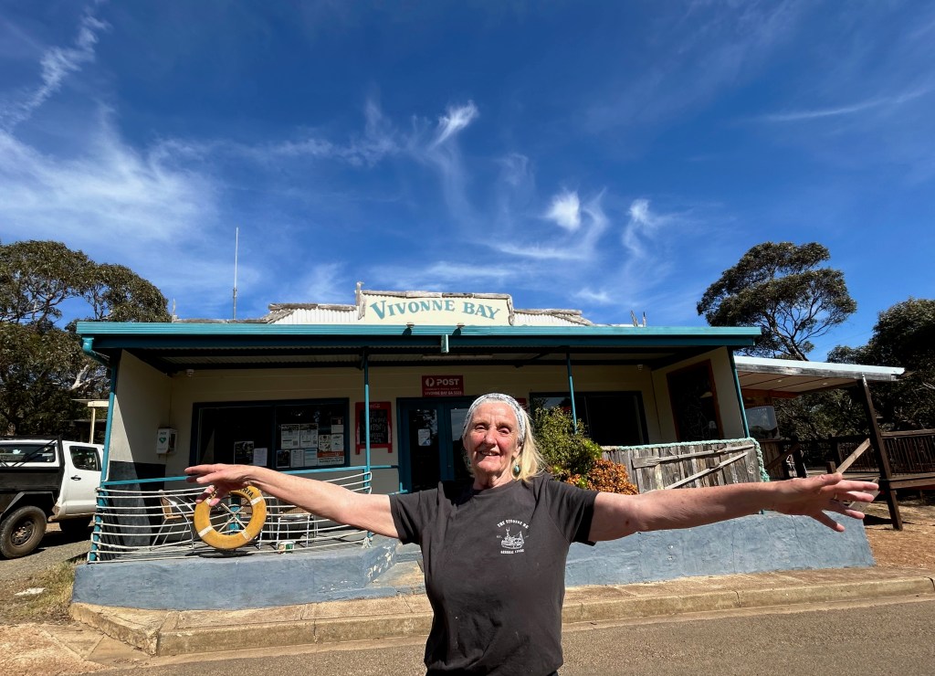
Yet the store, like so much of Kangaroo Island, reveals much more once you take the time to stop, and search for what is beyond … wonder about the people and the stories they have to tell.
Deb was busy chopping the parsley and getting all the fresh ingredients together.
Having grown up in Newcastle she moved to Noosa before finding her home on Kangaroo Island. And she had some stories to tell, with a good sense of humour.
The fish burger was worth the drive – a whole piece of fresh, crispy whiting served in turkish-style bread with lettuce, tomato, cucumber and mayonnaise.
Searching for Koalas, and Waiting for the Penguins will be posts in the future …. simply too much happened to fit into one effort.

VOYAGES OF DISCOVERY
French explorer Nicolas Baudin’s voyage of discovery to Australia and the South Pacific is remembered in part by his ships Naturaliste and Geographe through landmarks in Western Australia – Cape Naturaliste and Geographe Bay.
Discord within the expedition, especially between Baudin and the young zoologist François Péron, contributed to a damaged reputation.
The expedition’s reports and collections were not widely published or disseminated, leading to many investigators overlooking the specimens and scientific work.
Péron, who was antagonistic towards Baudin, took over the publication of the expedition’s account, which may have further skewed the presentation of Baudin’s achievements.
Only in more recent times has Baudin’s role in the voyage begun to be acknowledged and understood.
For Matthew Flinders, he was unaware that England and France were at war when he arrived in Mauritius seeking repairs for his leaky ship, the Cumberland. Despite being a prisoner, Flinders continued to work on his charts and journals, including his map of Australia, during this period. He was eventually released and returned to England, where he published his voyage and maps.
On 14 June 1810 Flinders sailed for England. He arrived on 23 October and received belated promotion to post captain. In failing health he prepared his monumental work A Voyage to Terra Australis; it was published on 18 July 1814, the day before he died.
Matthew Flinders is credited with suggesting the name “Australia” for the continent, which was previously known as “New Holland.”
Dutch explorer Abel Tasman charted the west coast of the continent in 1644.
In 1770 James Cook claimed it for Great Britain and it became the colony of New South Wales.
The great southern land had been speculated on in some maps since the 5th century, under the theory of “balancing hemispheres.”

